
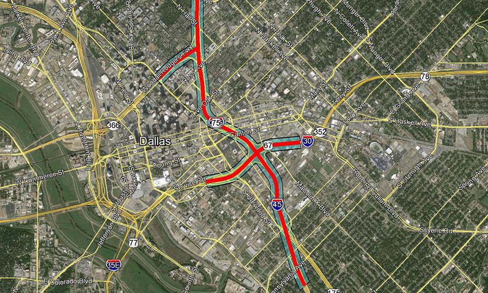
Huitt-Zollars provided aerial mapping, survey control, and supplemental topographic surveying for a 3.5-mile section of Interstate 345 in Dallas, Texas. The project consisted of a combination of traditional aerial mapping and Light Detection and Ranging (LiDAR) mapping within a heavily developed area in Downtown Dallas. Aerial mapping control was established through the use of GPS and conventional surveying methods. Surveying was performed for the Texas Department of Transportation to be utilized for design and improvement of the existing roadway and bridges.
Interstate 345 Surveying
Dallas
Client
Texas Department of Transportation