
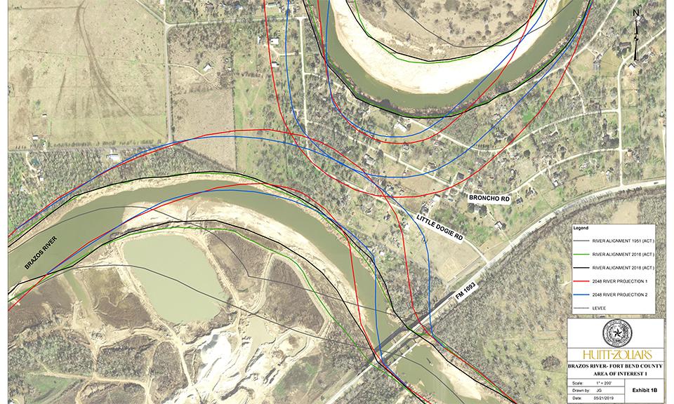
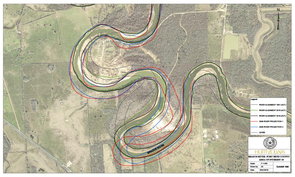
Due to the accelerated erosion of the banks of the Brazos River throughout Fort Bend County from the significant rain events in May 2015, April 2016, and Hurricane Harvey in 2017, Huitt-Zollars was contracted by the Fort Bend County Drainage District to investigate, analyze, model, and develop probable construction costs to address bank erosion at critical sites along 89 miles of the Brazos River through Fort Bend County, Texas. The continued erosion jeopardizes the structural integrity of bridges, pipelines, electrical transmission towers, other infrastructure, levees, roads, parks, and drainage outfalls. Our scope of work included soil investigations at three locations along the river and erodibility soil testing at Texas A&M University. We performed geomorphology analyses for the meander migration of the Brazos River for the next 30 years based on both a Time Sequence Analysis with Extrapolation Method and the Texas A&M University's Observation Method for Meander Migration (TAMU-OMM). This method results in a site specific meander migration prediction based on the past observed movement of the meander, the past flow hydrograph, the erodibility of the soil at the meander site, and an assumed future hydrograph. For this project, the meander migration of the river at 23 separate locations was predicted with probabilities along with associated consequences to develop a risk matrix. Finally, we developed potential solutions to control, minimize, or prevent future bank erosion to include probable construction and mitigation costs for the selected locations.
Brazos River Bank Erosion Study
Fort Bend County
Client
Fort Bend County Drainage District